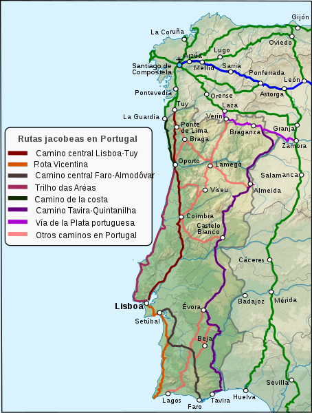
Currently, what is called the Portuguese Way includes a series of alternative roads and routes that were adopted over the centuries, the most recognized and well documented being the Portuguese Central Way, which links the cities of Lisbon and Santiago. Among the other most travelled routes by pilgrims are the Portuguese Way along the Coast, which for its natural beauty is still the most popular, and the Inland Portuguese Way, which is just as laden with the weight of history as the Central Way.
There are also many other secondary routes that the associations of pilgrims and Portuguese public administrations are recovering and signposting. Some of these routes are in the south of the country, others are around the city of Lisbon and there is a third group near the Spanish border which is linked to the Vía de la Plata, of which there are Portuguese variants known under that general name or by the names of the people who visited or documented them, such as Camino Torres, named after Diego de Torres Villarroel. To all of them we must add the historical itinerary known as Camino de la Geira, which unites the cities of Braga and Compostela.
For the pilgrim wanting to travel one of the routes of the Portuguese, we recommend the three main itineraries, now well signposted and with enough services to guarantee a pilgrimage without too many problems. In order to facilitate the choice of route, we offer here an introduction to the distances, estimated stages and main s or localities that they pass through.
In the case of the Central Way, the essential data on distances and stages are: from Lisbon to Compostela, the distance to cover is approximately 604 kilometers, which, taking into account the difficulty and infrastructures, most of the guides divide into 19 stages; if the pilgrim chooses to start in Oporto the kilometers are reduced to 236 and the stages to 10.
If landscapes or towns are the fundamental reasons for choosing a route, in the case of the central route we can draw your attention its passage through Lisbon, Santarem, Coimbra and Porto. From Porto there are two options, the one is a direct route towards Tui through Barcelos, while the other is to make a detour and visit the city of Braga, which means walking an extra 25 kilometers. The Camino continues through Ponte de Lima and enters Galicia through Valença, crossing Tui, Redondela, Pontevedra, Caldas de Reis and Padrón, from where the city of Santiago is finally reached.
The Camino de la Costa begins in the city of Oporto and its route to Santiago is 296 kilometers, which, following the same practical reasons indicated before -difficulty of the terrain,the existence of shelters and other services- are usually divided into 11 stages.
The most important characteristic of this route is, undoubtedly, the presence of the Atlantic Ocean, which accompanies the pilgrim along most of the route between Oporto and Redondela, where it joins the Central Way. Among the cities or towns that it crosses, we would point out those of Vila do Conde, Esposende, Viana do Castelo, Caminha, and, on reaching Galician territory, A Guarda, Baiona and Vigo.
The third option that we recommend to pilgrims is the Camino del Interior, which, as we have said, has great historical importance, being as well documented as a pilgrimage route as the Central Way. Although, historically, it started in the Algarve- in Faro or Tavira- the recovered and signposted route that pilgrims usually start from is in Forminhao, south of Viseu, and consists of 395 kilometers that are usually divided into 18 stages.
Regarding the most well- known or important landmarks of this route, it crosses the towns of Viseu, Lamego, Vila Real and Chaves. It then enters Galicia through Verín and continues on towards Santiago by passing through the Sanabrés Way, a variant of Vía de la Plata, then crossing Xunqueira de Ambía, Ourense, Cea, Dozón and Silleda, and finally entering Compostela through the outskirts of Pico Sacro.
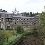
Photo: We have taken this image of the Commons Wikipedia project, its author is Paulusburg.